Originally published by GEODNET on 3 October 2026. Full article reproduced below. The views and claims below are those of the original publisher.
Hey everyone,
Your phone can be three meters off and you’d never notice. You’d just glance up, see the coffee shop, and walk over. A robot doesn’t get that luxury. This week we’re breaking down why the gap between “roughly right” and “exactly right” is the whole game for autonomous machines. We’ll also recap INTERGEO in Munich, where 18,500 of the people building that future spent three days on the show floor, and cover a genuinely big couple of weeks for physical AI. Let’s get into it.
GPS Got Us Here. Robots Need More.
Standard GPS is remarkable. It gets you to a restaurant, tracks a delivery, and finds your parked car, but it can still be off by several meters depending on your device and conditions. For a person, that’s a shrug. For a machine, it’s the difference between working and not working. Picture an autonomous mower three meters off its line, a tractor planting three meters from its row, a drone landing three meters from its charging pa d, or a construction robot drilling three meters from the plan. “Close enough” stops being close enough the moment a machine has to act on where it thinks it is.
That’s what RTK, or Real-Time Kinematic positioning, actually fixes. It doesn’t replace GPS, it corrects it. A reference station at a precisely known location watches for errors in the satellite signal and broadcasts corrections that a nearby receiver can apply to its own position. The result is accuracy measured in centimeters instead of meters, and GEODNET’s global network of reference stations is exactly that correction layer, available to any compatible receiver, anywhere the network reaches.
Watch the difference RTK/GNSS precision makes in the real world!
Live From INTERGEO: 18,500 Reasons This Matters
INTERGEO wrapped up in Munich in mid-September. It’s the world’s leading trade fair for geodesy, geoinformation, and land management, and this year drew more than 500 exhibitors and 18,500 visitors from 119 countries across three days. Esri founder Jack Dangermond opened the show with a keynote to the whole conference floor, and this year’s themes were exactly the ones GEODNET was built for: AI, digital twins, and reality capture turning physical space into usable data.
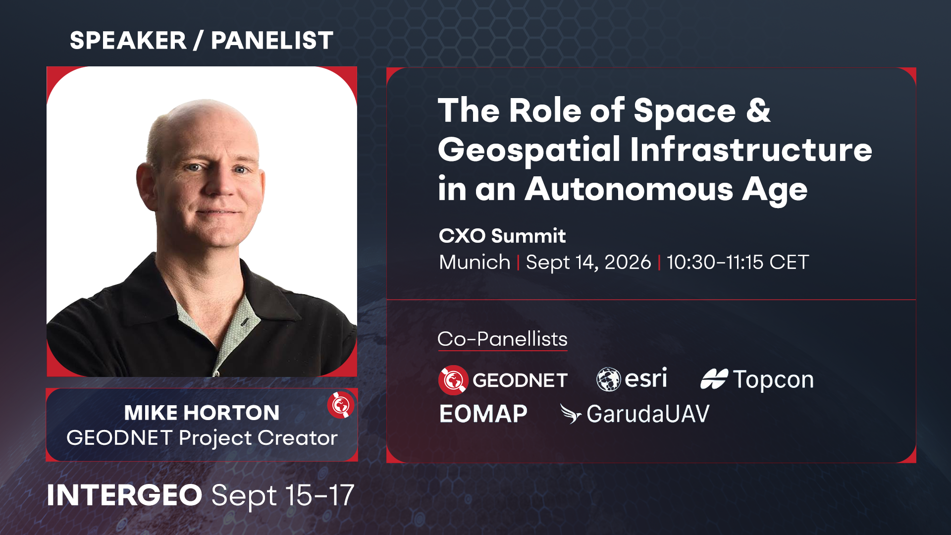
The day before the show floor even opened, GEODNET Project Creator Mike Horton took the stage at the CXO Summit for a panel on The Role of Space and Geospatial Infrastructure in an Autonomous Age, alongside leaders from Esri, Topcon, EOMAP, and GarudaUAV. It set up exactly the argument we’re making below: the machines running on all this infrastructure only work if the positioning underneath them holds up.
GEODNET exhibited at Hall B6, Booth B039. For a floor full of surveyors and geospatial professionals, we led with GEO-MEASURE, our handheld GNSS receiver built for exactly this kind of fieldwork, priced at $695 with a full year of RTK corrections included. If you stopped by, thank you. If you missed it, GEO-MEASURE isn’t going anywhere.
Physical AI Just Had One of Its Biggest Stretches Yet
While INTERGEO was underway, the rest of the robotics world didn’t slow down. Universal Robots launched its seventh-generation platform at IMTS last month, a fully AI-ready industrial robot arm built around open APIs and ROS2, with more than 20 ecosystem partners already building on top of it. Agility Robotics rolled out an upgraded Digit humanoid with new legs and batteries. And industry trackers are pegging global humanoid shipments up roughly 272% year-over-year in the first half of 2026 alone.
Every one of those machines runs into the same wall we talked about above: intelligence means nothing if the machine doesn’t know exactly where it is. That’s the whole thesis behind Rails for Physical AI. As more of this hardware ships, the demand for centimeter-accurate positioning doesn’t just grow, it compounds. Every GEODNET station is already part of that infrastructure, and every station host gets paid as that demand grows.
What's Powering Your GEODNET Rewards
Every station in the GEODNET network gets paid for the positioning data it provides — and demand for that data is only growing.
— The GEODNET Team